String Lake Hiking Trails – Something Here for Everyone

String Lake Hiking Trails – Something Here for Everyone

String Lake Hiking Trails – Something Here for Everyone

String Lake Hiking Trails

Many hikes, from beginner to advanced, start and end here at String Lake.

Here we will discuss specifically the trails close to String Lake.

String Lake Hiking Trails Pin
String Lake provides many trail options for hiking – short, long, medium, flat, varied elevation, in and out trails, and loop trails.

String Lake to Leigh Lake Overlook/Portage

Distance: 2.0 Miles RT Elevation Gain: 90 ft Trail Type: In and out Difficulty: Easy

One hike we do every year (especially with little kids and/or non-enthusiastic hikers) is the hike to Leigh Lake Overlook/Portage. It is the trail marked in red on the map.
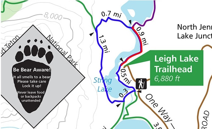
Map of hiking trails at String Lake in Grand Teton National Park

Map of Hiking Trail from String Lake to Leigh Lake Portage in red

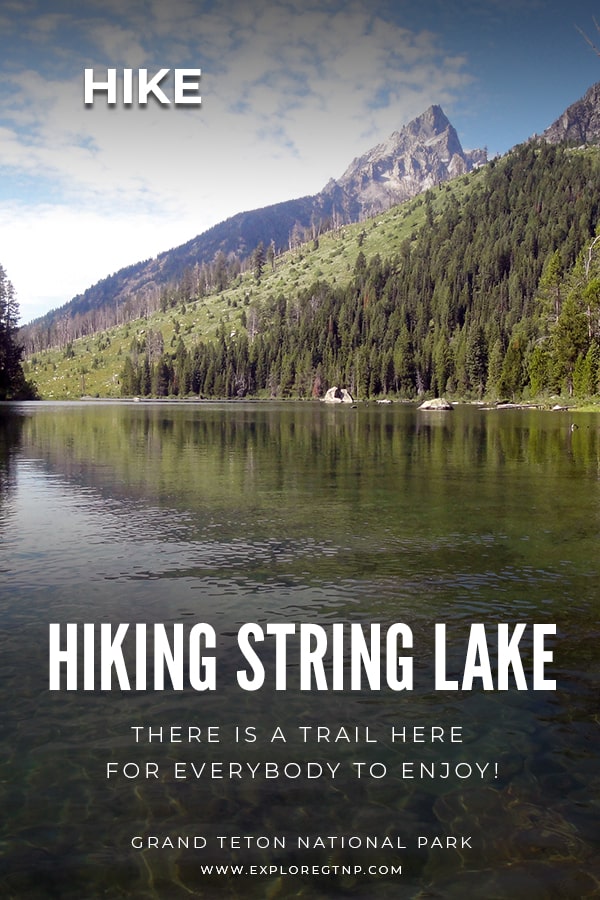
It’s a short hike, about one mile to Leigh Lake (Leigh Lake Overlook/Portage), and then one mile back. It’s a flat hike that follows along String Lake, giving you lake views with the Tetons in the background.
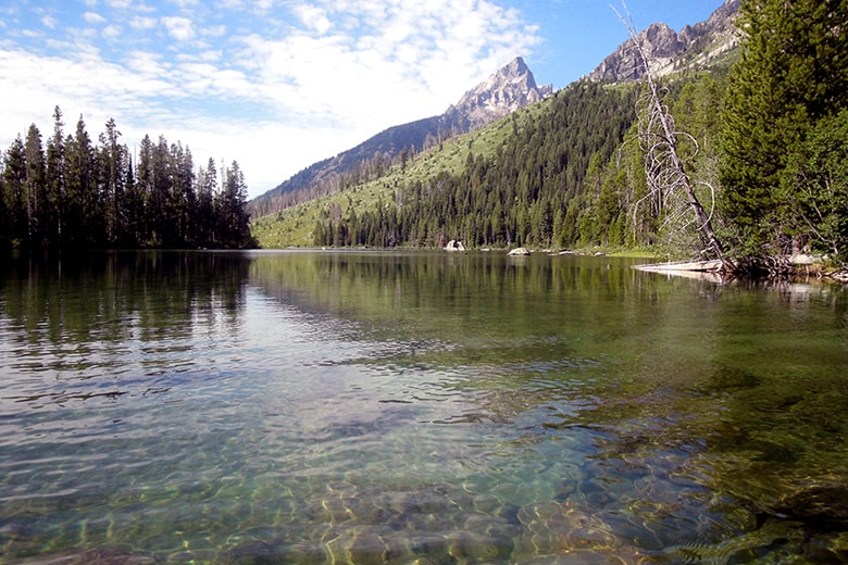
View of String Lake from the Hiking Trail

String Lake

As you walk along String Lake, you get an idea of how shallow the lake is, good for swimming, wading and playing around. You’ll know you have reached the overlook when you see the long wooden stairs. Go down the stairs and touch the water to see how cold it is.
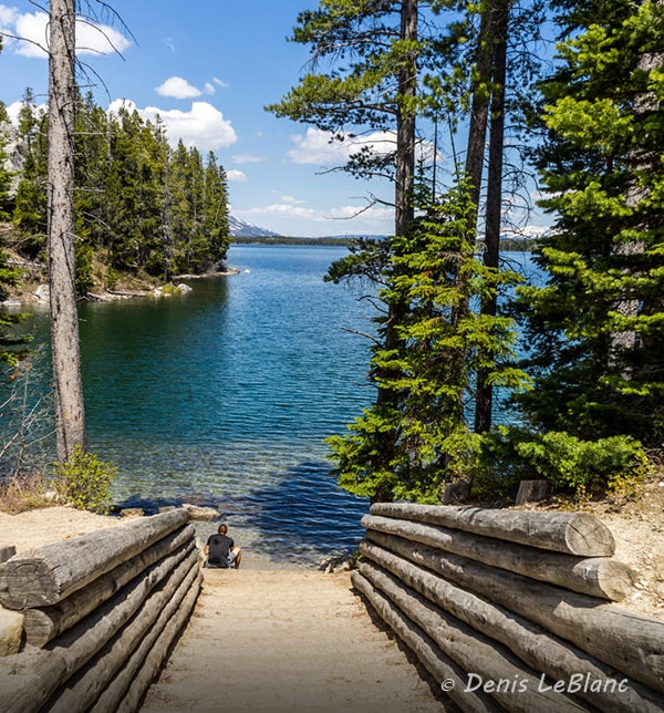
Leigh Lake Portage Steps overlooking Leigh Lake

Leigh Lake Portage Steps Photo by: Denis LeBlanc

Leigh Lake to Bearpaw Lake

Distance: 7.4 miles RT Elevation Gain: 110 ft Trail Type: In and out Difficulty: Moderate

If you do the Leigh Lake Overlook/Portage hike and reach the overlook, and want to keep hiking, you can backtrack from the overlook to the fork in the trail (about 1/10 of a mile) and continue on walking along Leigh Lake for as long as you want to go. It is the trail marked in purple on the map.
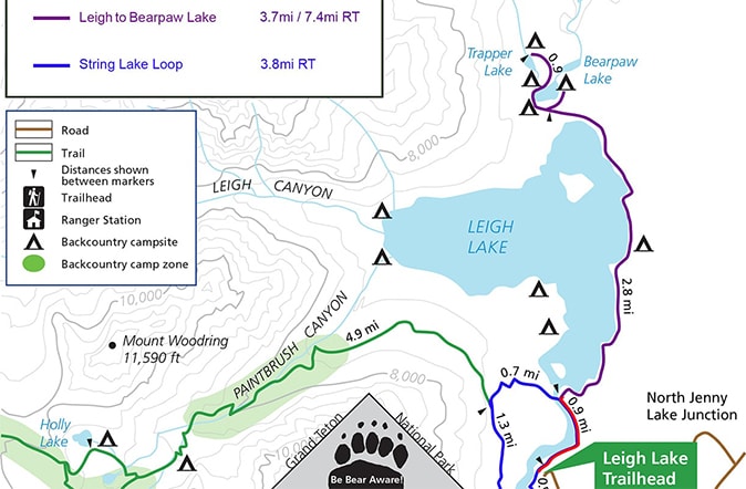
Map of String Lake Hiking Trail to Leigh Lake and then on to Bear Paw and Trapper Lakes

Hiking Map Continuing on from Leigh Lake to Bearpaw and Trapper Lakes


It’s an in and out trail, so you can go all the way to Bearpaw and Trapper Lakes (7.4 miles RT) or follow the trail for as long as you want and turn around anytime.

Leigh Lake on String Lake Hiking Trails

Leigh Lake

NOTE: The 7.4 miles RT is from Leigh Lake to Bearpaw Lake, to get back to the parking lot, you still need to go back along String Lake which is another .9 miles. So, round trip from the parking lot is actually 9.2 miles
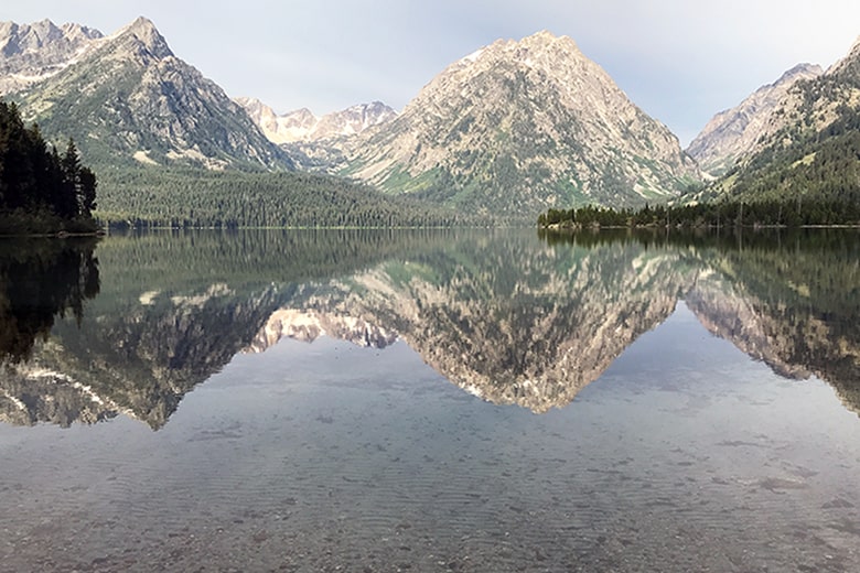
View of Leigh Lake looking west with Tetons in background

Leigh Lake Looking West

As you walk along Leigh Lake you’ll notice it is not as shallow as String Lake. It is shallow for a while, but drops off quickly and is very deep. Deep water is colder water and therefore String Lake is preferable for swimming. 🙂 You will know you are at the end of Leigh Lake when the trail veers into the trees and into a more open field area. To continue on to Bearpaw Lake, you’ll come to a junction on the trail. You can go to the right and see two camp spots in the trees bordering the east shore of the lake. To get to Trapper Lake, you will have to retrace your steps to the junction and go left.
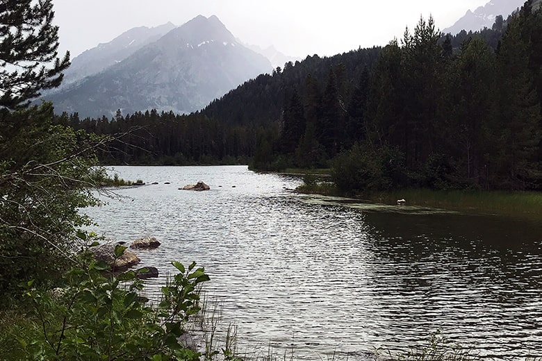
East Side view of Bearpaw Lake

Bearpaw Lake – East Side

Going left at the junction will put you on the western side of Bearpaw Lake and you’ll find more camps spots. Then you continue on the trail to Trapper Lake.
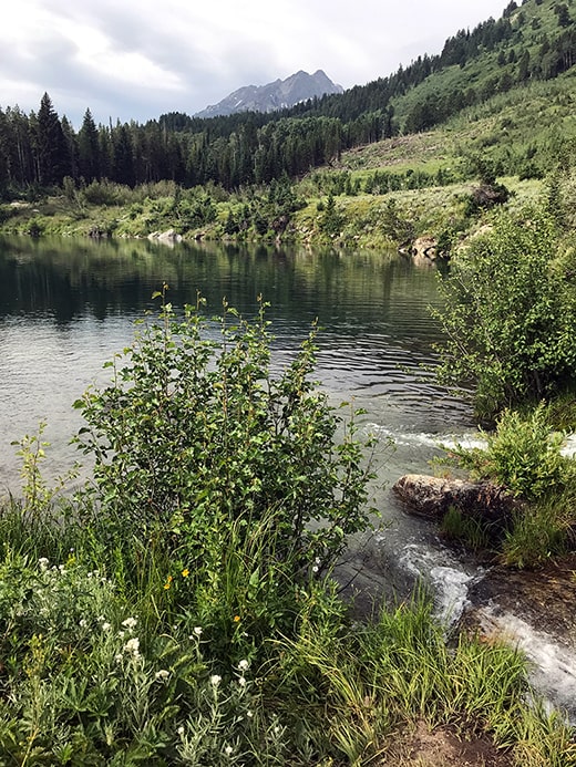
Trapper Lake in Grand Teton National Park

Trapper Lake

Again, this is an in and out trail, where you will leave the way you came.

We like walking up to Bearpaw and Trapper lakes, but many people turn around at the end of Leigh Lake.

All options are worth your time and it comes down to personal preference.

Hiker’s Note: This hike is a good one to do early in your vacation to get your “hiking legs”. The distance is long for a good workout, and the elevation is flat, so you won’t be gasping for breath like the high elevation gain hikes. If you are going to do a high elevation gain hike during your stay, consider “practicing” with a long, low elevation gain hike like this one.

String Lake Loop

Distance: 3.8 miles RT Elevation Gain: 275 ft Trail Type: Loop Difficulty: Easy

Another hiking option is to hike around String Lake. The String Lake Loop Trail is another option for you if you want to keep hiking after going to Leigh Lake Portage (the stairs). From the stairs, turn around and retrace your steps back to the footbridge on String Lake. It is the trail marked in blue on the map.

Map of String Lake Loop in Blue

Map of String Lake Loop Trail in Blue


This hike has more variation in elevation, not as flat as Leigh Lake trail. This trail pulls away from String Lake on the north and west sides and brings you around to where String Lake feeds into Jenny Lake.
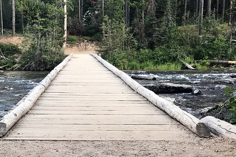
String Lake footbridge before Leigh Lake

String Lake Footbridge found before Leigh Lake

This footbridge is an excellent place for pictures.
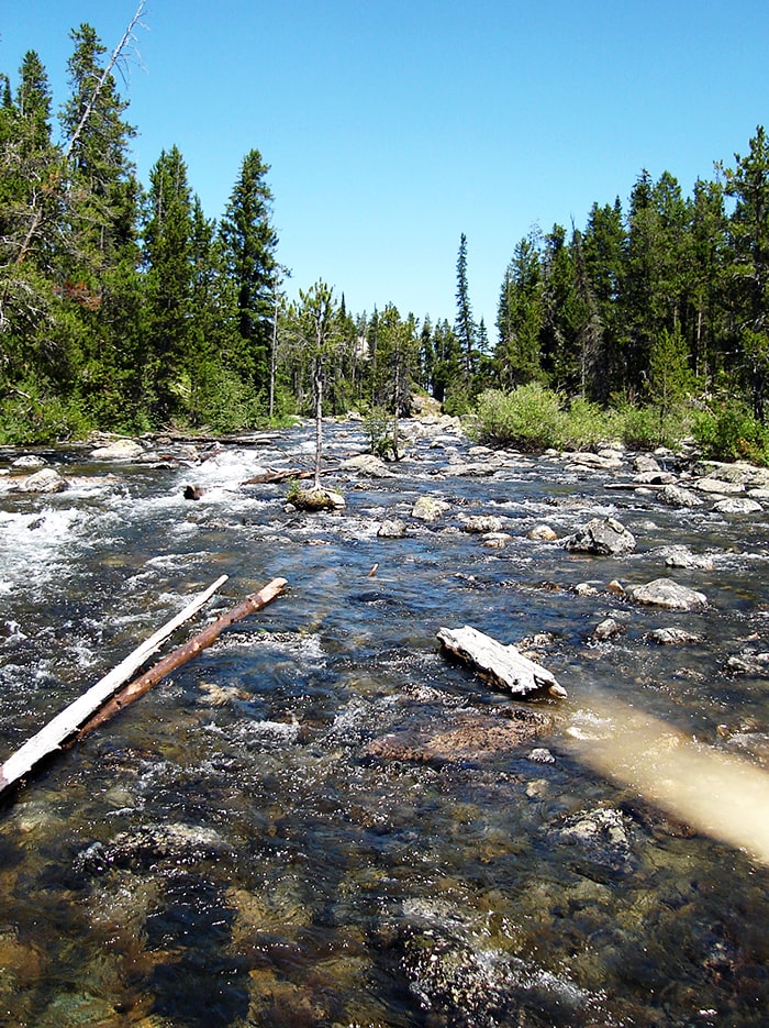
View on String Lake footbridge looking towards Leigh Lake

View on String Lake footbridge looking towards Leigh Lake

After crossing the footbridge you will start up a moderate climb through the forest and come to Paintbrush Canyon Junction, keep heading straight and you will start to descend and eventually see views of String Lake once again, this time from the west side of the lake.
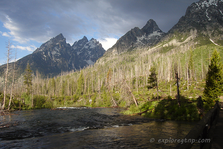
String Lake Loop Trail

View from String Lake Loop Trail

When you come to Jenny Lake Junction, head left and you will soon come to another footbridge over String Lake outlet. Cross the bridge, turn left and follow the trail until you are back where you started.

Summary

  • Leigh Lake Overlook/Portage is a great hike for little kids
  • While hiking along String Lake, keep an eye towards the mountains for views and places to swim
  • There are many sandy areas along Leigh Lake that are great for pictures and wading
  • Along the eastern shore of Leigh Lake, the water is shallow, but it drops off into deep water
  • Definitely have bug spray

Bear Safety
Using Bear Spray
How to Use Bear Spray Video

More questions about the hiking options at String Lake? We’d love to hear from you! Please let us know in the comments section.

Keep Your Eye Peeled for a Moose!

jenn c signature
Jenn Cunningham
Founder, Explore GTNP

Grand Teton 3 DAY Itinerary

If you are looking for ideas of what to do and see in Grand Teton National Park, and how to do it efficiently to make the most of your time, check out our Grand Teton 3 DAY Itinerary.

Explore GTNP's Grand Teton 3 DAY Itinerary
All the best places to see, hikes to do, places to dine, and the fun to have laid out in this 3 Day Itinerary.

Grand Teton National Park - Jenn on Jackson Lake in Canoe with Mt Moran in the background

Hi, I'm Jenn, pictured here on Jackson Lake in Grand Teton National Park. I am a Wyoming native and have vacationed every year of my 40+ years in Grand Teton National Park. I know this park inside and out, so use my years of experience and knowledge to plan, go, and do your perfect Grand Teton National Park vacation!

Hike Lunch Tree Hill – Short Hike with a Big View

Hike Lunch Tree Hill – Short Hike with a Big View

This post may contain affiliate links. Please read our disclosure for more info.

Hike Lunch Tree Hill – Short Hike with a Big View

Lunch Tree Hill hike is one of the shortest and easiest hikes in Grand Teton National Park (GTNP) with one of the biggest views. AND… it’s less than .5 mile round trip.

Lunch Tree Hill - A Short Hike with a Big View - exploreGTNP.com

Less than half a mile.

That is perfect for those under a time crunch, for families, and/or for little or unenthusiastic kids.

.5 mile, the kids won’t have enough time to complain. Win-win!

And while this hike is shorter and easier than most, don’t equate it with being boring or one to skip.

While you aren’t going to get a high-calorie burn or workout, you are going to get:

  • Fantastic Views
  • History
  • GTNP Geology
  • GTNP Animal Info
  • Possible Wildlife Viewing

That’s a lot for a half-mile hike!

The Hike

You can find the beginning of Lunch Tree Hill Trail off the northern edge of the back viewing area of Jackson Lake Lodge. The easiest way to get here is to go through the lodge and turn right.

The beginning is a little steep, but the trail is paved and short at two-tenths of a mile.

The sign will say “Lunch Tree Hill Loop Trail” but I highly recommend skipping the loop and just going up to the Rockefeller Monument and back. You’ll know you have reached the top when you get to the large rock with a plaque dedicated to Rockefeller.

View

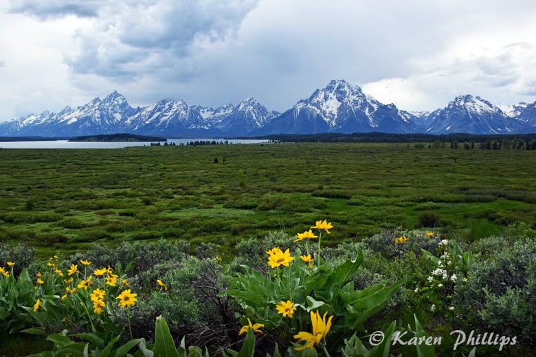
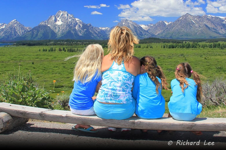
The entire Teton range will be in full view, unobstructed, going up and back on this trail. The lake in the background is “Jackson Lake” and the island you see on the lake is “Donoho”.

The View from Lunch Tree Hill Grand Teton

The View from Lunch Tree Hill – Photo by: Richard Lee

Sprawling in the foreground to Jackson Lake and the Tetons are the green, wet, marshy Willow Flats.

History

Okay, here is why this hike is such a big deal.

In 1926, if Horace Albright, the superintendent of Yellowstone National Park hadn’t brought John D. Rockefeller and his family to the top of Lunch Tree Hill for a picnic lunch, Grand Teton National Park might not exist.

It is reported that John and his wife, Laura, fell in love with the Tetons and the landscape they viewed on this picnic, but were appalled by the encroaching commercialization of the area. Dance halls and gas stations littered the area. After the picnic with Albright, the Rockefellers eventually bought up the entire valley and gifted it to the U.S. Government to be placed under the National Park Service.

Thank you Horace Albright, and to the Rockefellers for giving us the Grand Teton National Park we have today.

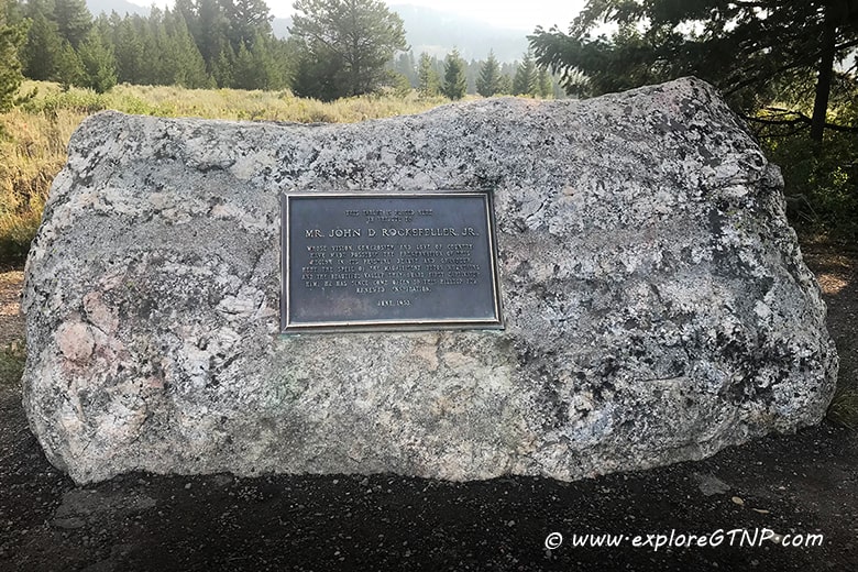
At the top of the hill, is a large rock with a plaque marking the spot of “THE Picnic”. Don’t be surprised if kids want to climb on the rock.

Dedication to John D. Rockefeller - www.exploreGTNP.com

Dedication to John D. Rockefeller

Photo idea: Have people sit on the rock and get the Tetons in the background. The plaque won’t show, but you can get that in a separate photo.

Geology

Along the path, you will find short, informative plaques every few yards. Two of the plaques are focused on the geology of the Tetons.

One plaque helps onlookers identify the “Grand Teton”, the tallest peak in the Teton mountain range, at 13,770 ft elevation.

View from Lunch Tree Hill. Photo: © Karen Phillips @ http://wishuponanrvstar.blogspot.com/

View from Lunch Tree Hill. Photo: © Karen Phillips http://wishuponanrvstar.blogspot.com

The other is dedicated to Mt. Moran, the large, flat top mountain in direct view.

Mt. Moran was named after the artist, Thomas Moran, whose paintings and drawings of the mountains and surrounding landscape in the 1870’s helped convince Congress to make Yellowstone the first National Park.

Animals

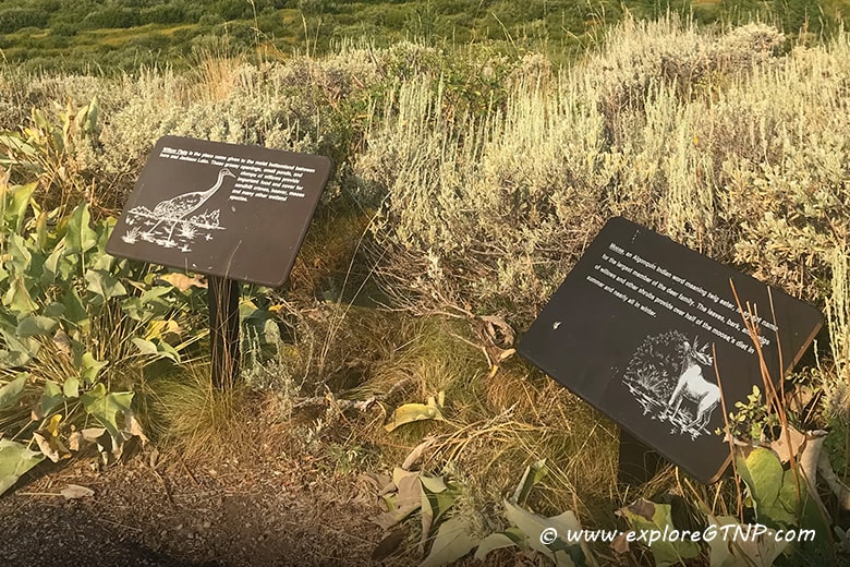
There are also plaques identifying the animals that can be found in the Willow Flats. Moose, beaver and sandhill cranes especially love the wetlands, but any animal can roam through here including elk, deer, and bears.

Animal Info along Lunch Tree Hill Trail - www.exploreGTNP.com

Animal Info along trail

And while the Willow Flats is a good place for animals, you will need binoculars to see them from this vantage point.

This hike is perfectly named as it is a short jaunt to take the family and picnic at the top with a stunning view.

Go Back the Way You Came

As mentioned earlier, the best use of time is to go back the way you came instead of doing the full loop. The top of the trail is at the Rockefeller rock. When ready, retrace your steps back down the hill to the viewing deck of Jackson Lake Lodge.

Hope you see some wildlife, with or without binoculars!

If you have any additional questions, feel free to put them in the comments section.

Keep Your Eye Peeled for a Moose!

jenn c signature
Jenn Cunningham
Founder, Explore GTNP

10 Tips To Help You Plan Your Grand Teton National Park Vacation

Get this FREE information for your vacation from ExploreGTNP.

We won't send you spam. Unsubscribe at any time. Powered by Kit

Grand Teton National Park - Jenn on Jackson Lake in Canoe with Mt Moran in the background

Hi, I'm Jenn, pictured here on Jackson Lake in Grand Teton National Park. I am a Wyoming native and have vacationed every year of my 40+ years in Grand Teton National Park. I know this park inside and out, so use my years of experience and knowledge to plan, go, and do your perfect Grand Teton National Park vacation!

Lakeshore Trail Hike at Colter Bay

Lakeshore Trail Hike at Colter Bay

Lakeshore Trail Hike at Colter Bay

Distance: 2 Miles RT
Elevation Gain: 150ft
Trail Type: Loop
Difficulty: Easy

Colter Bay Village
100 Colter Bay Village Rd, Moran, WY 83013

Directions

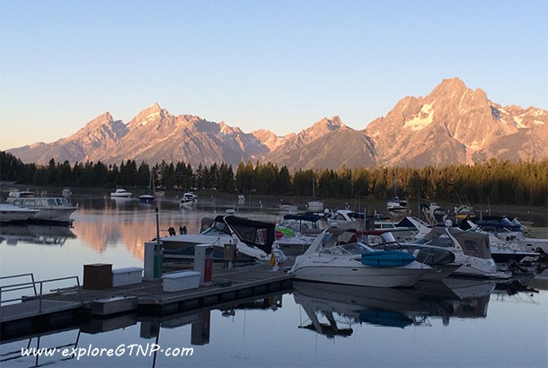
Lakeshore Trail at Colter Bay is a picturesque hike that includes a marina, boats, forest, lakeshore, and of course, nice views of Jackson Lake and the Tetons, especially Mt. Moran (12,605′ elevation).

Hike Lakeshore Trail at Colter Bay - www.exploreGTNP.com

This is a flat hike (with one short climb in elevation on the outer loop), that is a figure eight which gives you the option to do the entire 2-mile hike with the outer loop or a shortened 1-mile hike with only the inner loop.

Lakeshore Trail is a good hike for:

  • Beginners
  • Families
  • Kids
  • Viewing Jackson Lake
  • Unobstructed view of Mt. Moran (outer loop)
  • If you are short on time – you can usually do the hike in an hour and a half (the full two miles) or even less with the inner loop only, walking at a leisurely pace.
  • Seeing wildlife

Getting To the Trailhead

To get to the trailhead, you need to go to the marina by going through the village. Just keep heading towards the mountain until you hit the visitor’s center.

Once at the visitor’s center, you can go through the center by the bathrooms, or go to the left of the center and walk down to the marina. Both routes lead to the marina. Once at the marina, facing the mountains, head to the right, towards the teepee stand. The teepee cover is usually not up, so look for the stand.

Just beyond the teepee is a map box with all the hiking trails around Colter Bay. Take one and deposit the small amount of money requested.

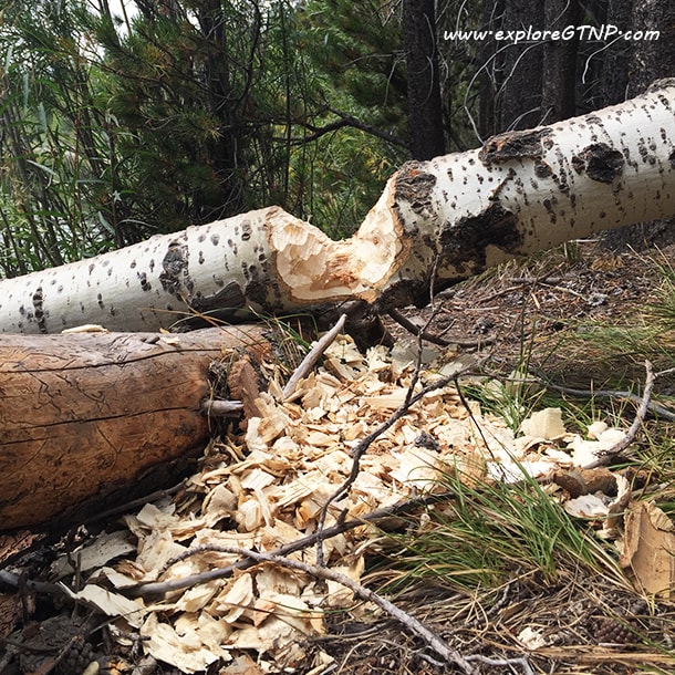
Follow the map and walk down the right side of the marina. It is a nice wide gravelly road in the trees. Be sure to look to the left. Along the lake, there are a few trees downed by a beaver that took residence in Colter Bay in 2015.

About (¼ mile) down the road, you will come upon Lakeshore trail on your right. You can turn here and continue on the trail, or take a short detour to the left to go to the point.

If you choose to go to the point, there are benches for sitting and viewing the mountains. The benches face the mountains (not the bay) and you will find a lot of rocks by the water’s edge, good for skipping.

At the very end of the point, you will be close enough to wave to the people in the boats coming in and out of the bay. Please do not skip rocks in their direction. 🙂

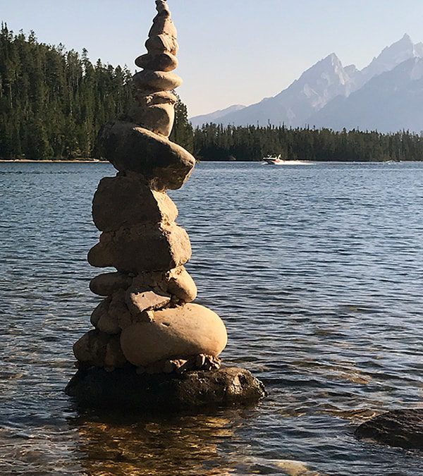
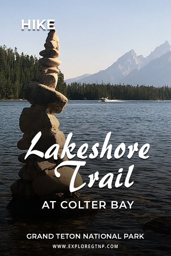
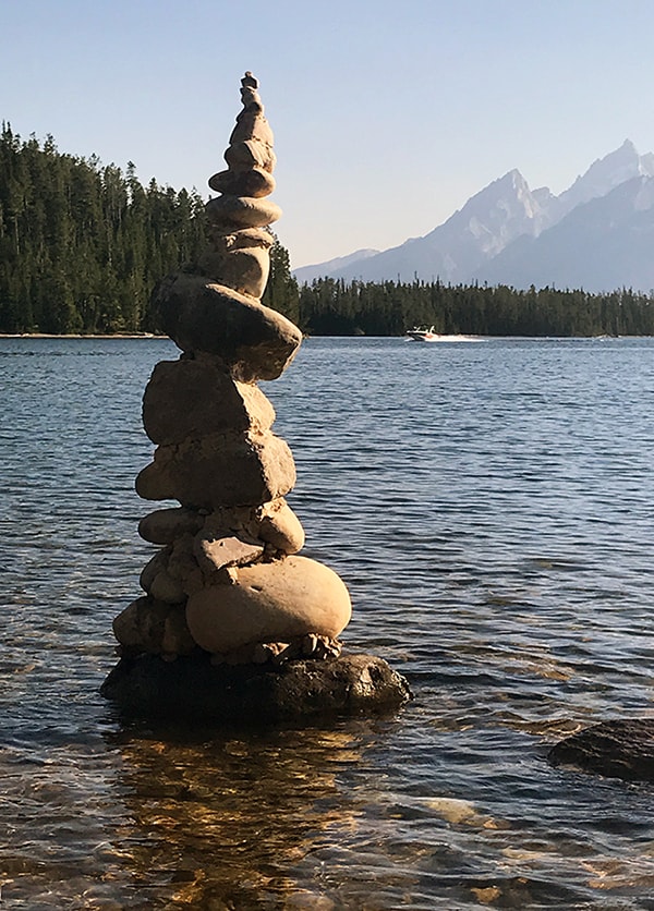
Cairn in Lake with Grand Teton in the background

Cairn found at the end of Colter Bay Point


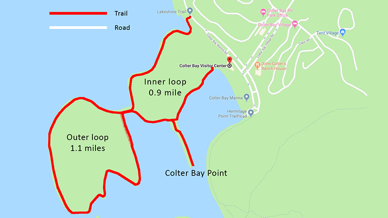
After the point, turn back and go to the Lakeshore trail sign and enter into the trees. Within 1/2 mile you will come to a junction in the trail, turn left to do the outer loop (1 mile RT) or continue to the right to do the inner loop. If you do choose the outer loop, note, it is a loop and it will bring you back to the inner loop, so you won’t be missing any parts of the trail.

If you choose to do the outer loop, you will cross a land bridge.


Map of Colter Bay Lakeshore Trail

Colter Bay Lakeshore Trail Map

We almost always see a deer or two on the outer loop. Keep your eyes peeled for one, and for all animals. Yes, that means bears too.

Do carry bear spray on this trail and for all the trails you go on, no matter how short.

Bear Safety
Using Bear Spray
How to Use Bear Spray Video

You will cross the same land bridge to come back to the inner loop.

The north side of the trail will give you views of Swimming Beach – note how rocky it is!

Continue on past the amphitheater to come back to where you started at Colter Bay Marina.

Know Before You Go

  • While it is called “Lakeshore Trail” the trail isn’t entirely along the lake’s shore. A good part of the trail is in the trees and in the forest.
  • No bikes or dogs allowed on the trail
  • If you have a hammock, there are some nice trees to set it up in when heading to the point, I recently saw a group making a day of it, laying in their hammocks, reading books and looking out at the Tetons
  • Bring plenty of water
  • Wear bug spray
  • Carry bear spray and know how to use it

Have any questions or comments about the Lakeshore Trail at Colter Bay? Post them in the comments. We’d love to hear from you!!

Keep Your Eye Peeled for a Moose!

jenn c signature
Jenn Cunningham
Founder, Explore GTNP

Grand Teton National Park - Jenn on Jackson Lake in Canoe with Mt Moran in the background

Hi, I'm Jenn, pictured here on Jackson Lake in Grand Teton National Park. I am a Wyoming native and have vacationed every year of my 40+ years in Grand Teton National Park. I know this park inside and out, so use my years of experience and knowledge to plan, go, and do your perfect Grand Teton National Park vacation!